West Linton Historic
Time – 1 hour
An easy stroll around the hsitoric village centre, with much to see of interest. The route is almost all on pavement and level for almost its entirety.
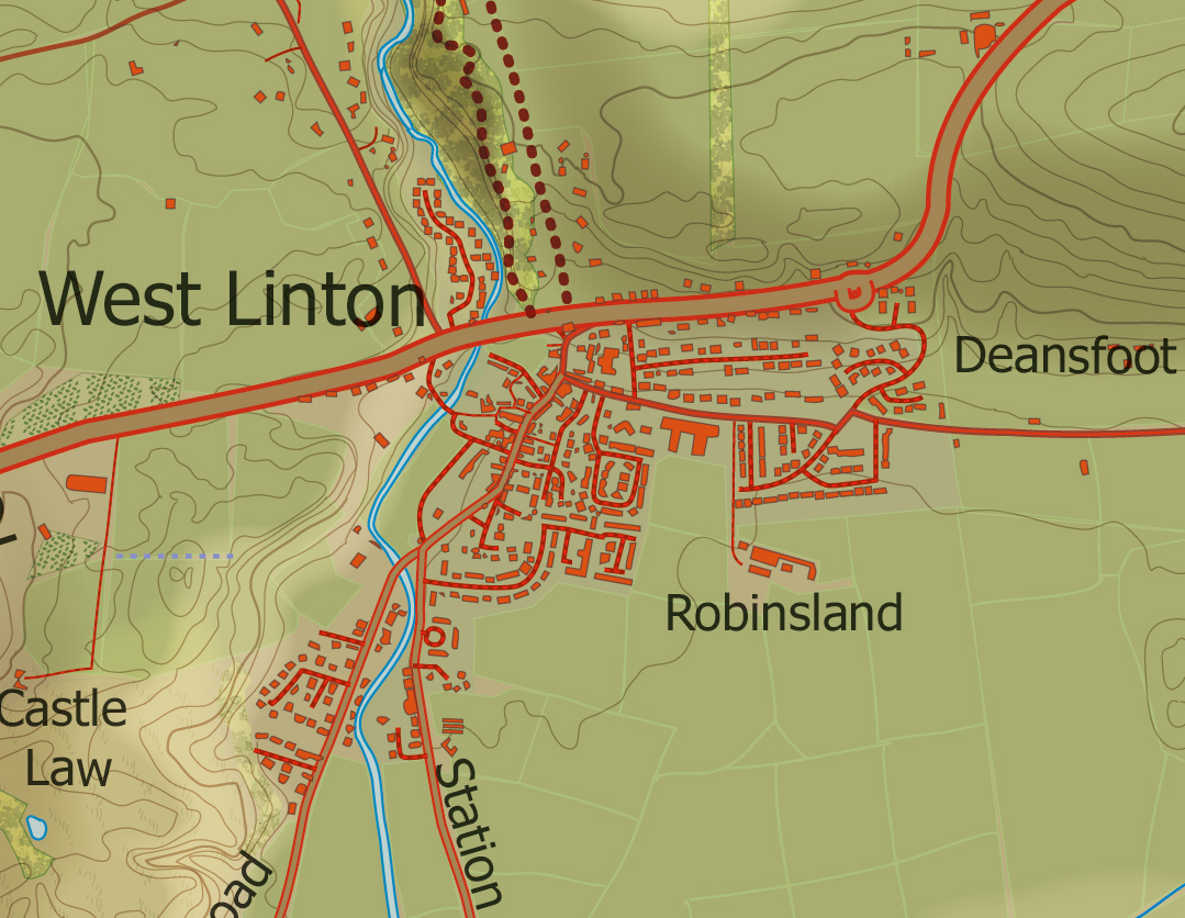
Route: Start/finish – West Linton
Centuries ago the village was known as Lyntoun Roderyck and was at the eastern boundary of the Kingdom of Strathclyde. Later it was incorporated into the diocese of Kelso and today it is part of the Scottish Borders. The change and development of the village over its thousand or so years of history is evident in its layout and architecture. The conservation area at the heart, with its winding main street and quaint alleyways contains mostly Victorian buildings set into a Mediaeval village plan of winding streets and alleyways which are well worth exploring.
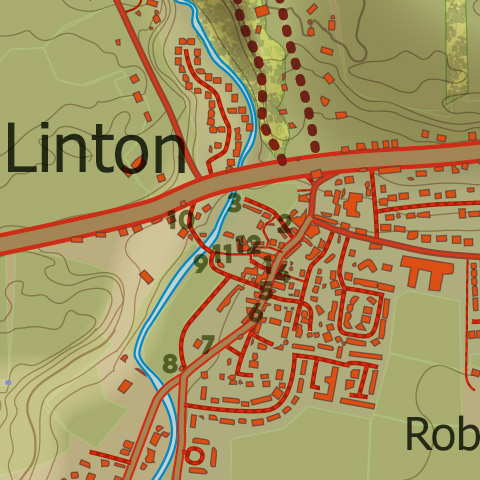
Start in the Raemartin Square (1 as marked on the map) at the west side of which stood the ‘Ha Hoose’ of the Feudal Superior or Lord of the Manor. Feus or rentals were tendered through a small hole in the wall at the back of the house on term days between the hours of midday and one o’clock.
Leaving the Square by the Main Street, turn left and then left again down the first alleyway past the ‘Fireside’, then turn right into Teapot Lane (2) so called, it is said, on account of the communal tap from which the housewives round about used to draw water for their all too frequent cups of tea. The lane opens on to the Upper Green with the Lyne Water flowing along its western edge.
Rumbling Tam Well (3) now discharges water into the Lyne from a stream the course of which until Victorian times ran down the Main Street and is said to account for the number of bends in the road.
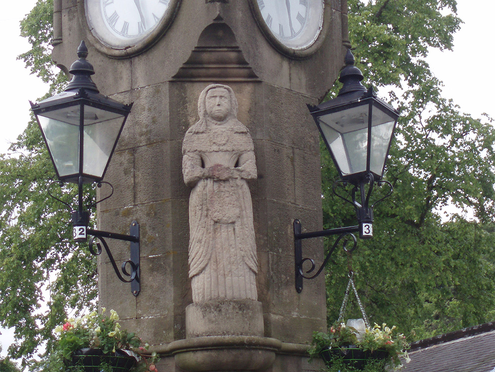
Head back to the Main Street and turn right back to Raemartin Square. On the gable end of the cottage opposite the square note the Gifford panel (4), a remarkable 17th century marriage stone carved by a local sculptor, James Gifford.
Opposite and a little further down stands the village clock on the site of the historic Cross Well which stood at the centre of the village square. On the small platform at the front of the clock stood, until recently, the 17th century statue of James Gifford’s wife (5). For reasons of preservation it is now housed in the Graham Institute village hall, with a replica in its place. On the opposite side of the road can be seen a carving of St. Andrew with his cross, on the gable end of the Victorian parish school (6), now much altered. The most notable building in the village is undoubtedly the Parish Church of St. Andrew standing at the foot of the Main Street (7). Built in 1782 and enlarged in 1871 it stand 50 metres or so to the south east of the site of the original village church, the origins of which go back at least a thousand years. In the adjacent Old Kirkyard are to be found many interesting early gravestones.
Near the church stands the Old Toll House (8) built in the early 19th century on the turnpike road as it entered the village. Tolls were levied on travellers including the many drovers and their animals passing through.
Linton was on a major droving route and at the peak of the droving trade 30,000 or more cattle a year plus large numbers of sheep would cross the Green, passing by the Tolls House. Failure to pay tolls was punished by the imposition of heavy fines.
The ford at the top of the Green (9) was, in the 17th century, the site of the only riot in West Linton’s history, when local folk, many of them women, objecting to the ‘imposition’ of a minister by the laird, defied the military sent out to restore order. Note St. Mungo’s Episcopal Church, dating from 1851 on the hill above (10). Leave the Green by Trinity Lane opposite the wooden bridge (11). On the left will be seen the building that was once the Old Secession Church and is now a private house (12). It was built in 1739 and was the first such church to be erected in the south of Scotland.
This short village walk ends back in Raemartin Square, so called after two former proprietors of the hotel, Mr. Rae and Mr. Martin